|
|
|
|
|
Professor of Marine Geophysics Specialties: brief Curriculum
Vitae |
|
|
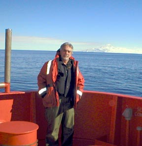
Bruce Luyendyk on stern of icebreaker N.B. Palmer in western Ross Sea. Ross Island in background. |
Office: Webb 2036 |
Learn about the
10th International Symposium on Antarctic Earth Sciencesand the upcoming
11th International Symposium on Antarctic Earth Sciences
Current and Recent Graduate Students. |
|
|
|
Marine Hydrocarbon Seeps - Christopher Stubbs Antarctica - Robbie Decesari (now at ExxonMobil) Marine Hydrocarbon Seeps - Tonya Del Sontro (now Doktorandin
in Dept. of Environmental Sciences, ETH Zurich) Folding in the Santa Barbara Channel - Sarah Hopkins |
Studies in the Ross Sea and Marie Byrd Land, West Antarctica. |
|
|
|
Geology of western Marie Byrd Land Air-ground study of tectonics at the boundary between the eastern
Ross Embayment and western Marie Byrd Land Our study used the SOAR facility aircraft (Support Office for Aerogeophysical Research). The SOAR system comprises carrier-phase differential GPS, 1.7 kW laser altimeter, 10 kW ice-penetrating radar, towed proton magnetometer, and a Bell BGM-3 gravimeter. We flew 37,000 km2 at a spacing of 5.3 km with 15.6 km tie lines, and 86,000 km2 with a 10.6 x 10.6 km spacing. Our study includes aerogeophysics combined with on-ground geology. Our rationale for a combined program is the complete coverage of crustal-scale structure from the airborne geophysics, and mountain-range and outcrop scales from the geologic field work. During the 1998/99 season the SOAR group finished flying the project area in western Marie Byrd Land (green boxes show our MBL survey, red and blue are other WANT surveys - image from M. Studinger). The survey area covers the Edward VII Peninsula, the Ford Ranges and a large portion of the West Antarctic Ice Sheet. Within this region are included 12 survey blocks about 112 km on a side. During December and January the SOAR Twin Otter aircraft acquired airborne magnetic, gravity, laser elevation, and radar ice thickness on flights over the survey area. Results of this survey are found in Luyendyk et al. (2003). Marine geology in the Ross Sea In 1996 we also conducted a site survey for the Cape Roberts Drilling Project offshore from the Transantarctic Mountains in southern Victoria Land. Our site survey was a critical component to siting the drill holes for this project. In addition, our data provided a meaningful context for the drilling results. By our interpretation we have identified a major fault zone along the Transantarctic Mountains front. And, we have shown structural evidence for the timing of uplift of these mountains during Oligocene time. In 2003 and 2004 we took the Palmer on a cruise to the far southeastern Ross Sea to investigate an area of sea floor recently exposed by the break-off of giant iceberg B-15 et al. This project is exploring the new ground in preparation for drilling into the sea floor at a future date with the ANDRILL project. GPS Measurement of Isostatic Rebound and Tectonic Deformation in Marie
Byrd Land, West Antarctica GPS measurements collected between 1999 and 2002 indicate no significant present motion between East and West Antarctica greater than 1–2 mm/year. Low strain rates imply that the Ross Sea rift is either inactive or active at a very low rate. This result indicates that the two subcontinents are likely joined as a single coherent lithospheric plate. They could have been joined since the end of Adare Trough spreading in Oligocene time. The volcanic activity in the Ross Sea sector at present such as at Mount Erebus is most likely related to mantle upwelling and not associated with continental rifting. GPS measurements of vertical rates indicate postglacial rebound of up to 12+/-4 mm/year in western Marie Byrd Land (wMBL). Errors are scaled 1sigma. The rock uplift rates are consistent with postglacial rebound models of significant ice thinning in the eastern Ross Ice Shelf in the late Holocene. The GPS stations (seen here in Rockefeller Mountains) gathered data for four years, and were installed in concert with a series of autonomous stations in the Transantarctic Mountains, resulting in an unprecedented long baseline array across the Ross Embayment. See Donnellan and Luyendyk (2004) for a review of the findings. All of the above projects are supported by the Office of Polar Programs, NSF. |
Marine hydrocarbon seeps off Coal Oil Point, Santa Barbara. |
|
|
|
(to see a copy of Luyendyk letter to the Santa Barbara County Board of Supervisors on the relationship between oil production (drilling) and decreasing seepage; click HERE). (To visit our Seeps Project page click HERE). Our project is studying the natural marine hydrocarbon seeps offshore from UCSB. We are employing a multidisciplinary approach including marine geophysics, marine chemistry, ocean engineering, and physical oceanography. Prolific natural hydrocarbon seepage occurs offshore from Coal Oil Point. Most of the seepage occurs in the form of gas bubble plumes which rise through the water column and vent into the atmosphere. The gas bubbles at the ocean surface contain 60% methane, 10% non-methane hydrocarbons, and 30% air. During gas bubble rise, the hydrocarbons partially dissolve in sea water while air is absorbed. Oil contained in the rising bubbles is left on the sea surface as slicks. The oil slicks gradually lose volatiles and become tar balls, eventually washing onto southern California beaches. The locations of the seeps are determined using sonar surveys controlled by differential GPS. In situ gas chromatograph observations are used to map the dissolved hydrocarbon plume which extends several km down-current from the vents. Oceanographic conditions are determined from high resolution CTD surveys, and moored vector-measuring and acoustic Doppler current meters. Preliminary analysis indicates that 1) the dissolved hydrocarbon concentration in the ocean is proportional to the gas seepage rate and inversely proportional to current velocity, 2) the seep gas flux has decreased ca. 50% over 22 years within one km of oil platform Holly, possibly correlating with a decrease in subsurface reservoir pressure due to oil production, and, 3) aqueous CO2 and H2 anomalies 2x and 100x above background, respectively, are associated with the dissolved hydrocarbon plumes and are interpreted to be due to oxidation of hydrocarbons by bacteria in the ocean.
Research supported by the UC Energy Institute, Petroleum Research Foundation, California State Lands Commission, National Science Foundation, NASA, and the US Minerals Management Service. |
Paleomagnetism and Tectonics of southern California and Mojave Desert. |
|
|
|
This research is concerned with the rotation of large regions of crust in southern
California during the last 20 million years. It has been ongoing since
1975. During the last few years I have been concentrating on two aspects:
1) crustal rotations in the Mojave Desert; and 2) a synthesis of data
and their evaluation (Luyendyk,
2001). In the Mojave my students and I discovered a crustal rotation
event which had occurred between 22 and 18 million years ago. This is
much earlier than the rotation event we had been studying in the Transverse
Ranges and elsewhere in southern California. We completed a study of the
tectonics in the northern Mojave Desert that found significant clockwise
block rotations since 11 Ma (Schermer
et al., 1996). Research also has been aimed at determining an accurate geochronology for volcanism and rotation events in southern California. Phil Gans, Marc Kamerling, and I conducted a project to date our extensive collection of southern California Neogene volcanic rocks by the 40Ar/39Ar method. This project has made a major impact on the volcanic stratigraphy of southern California and its connection with plate tectonic history, particularly the transition from subduction to transform margin (Luyendyk et al. 1998 in CV). Research supported by Earth Sciences Division, NSF, and the UCSB Academic Senate.
|
Tectonic studies in the western Transverse Ranges, and offshore southern and central California. |
|
|
|
These studies involve understanding the tectonics of the California continental margin during Cenozoic time. In one study the Hosgri fault was mapped for the first time at its southern end. Another study involved looking at deep crustal structure in the same area, using specialized deep seismic reflection profiling. We have found that ocean crust was presumably subducting in this area up to 29 million years ago, so we may have detected a remnant of anomalously old sea floor, the Monterey plate, beneath the margin. We have gone further with this observation and devised a new theory for why the Transverse Ranges rotated. Research supported by the California Sea Grant Program and the Earth Sciences Division, NSF. In a recent study we used seismic reflection data and mapped a blind fault beneath the shelf offshore from the Los Angeles Basin.
As part of our objective determine the history of shortening across the Santa Barbara Channel and Ventura Basin we performed a numerical experiment to flatten out folded late Neogene sedimentary units in the eastern Channel (Sorlien et al., 2000). The purpose of our study is to identify the main structures in the basin and its borders and to quantify their rate of deformation. Within the studied area, the total shortening due to folding and faulting since ca. 6 Ma is about 6 km in the east and a few hundred meters in the west. Most of the shortening is absorbed by reverse faulting and folds associated with reverse faults. This research was supported by the Southern California Earthquake Center (SCEC).
|
Tectonics
of the South Pacific Ocean
|
|
|
|
The Manihiki Plateau is a submerged volcanic feature covering an immense area
about the size of Texas in the southwest Pacific, east of the Samoa Islands
(161 W, 10-23 S). Investigations so far indicate it originated in Early
Cretaceous time (ca. 124 million years ago) from the rapid outpouring
of lavas onto the sea floor. It shares characteristics of other volcanic
plateaus in the southwest Pacific including the Ontong-Java and Hikurangi
Plateau. The latter submerged plateau, located adjacent to New Zealand,
has been proposed to be a matching part of the Manihiki Plateau that rifted
away from it via plate tectonics soon after formation. Other hypotheses
state the plateaus evolved separately and were never connected. The project described here was conducted by me and a group of seven undergraduates from the department of Geological Sciences, along with Rob Clayton, Joann Stock, and graduate students from Caltech. We used the R/V Roger Revelle of the Scripps Inst. of Oceanography to make a geophysical survey of the Plateau to determine how it fits into the Mesozoic history of the southwest Pacific. Techniques we used include multibeam sonar echo sounding, seismic reflection, and magnetics and gravity field measurement. We combined our data with that from researchers at Rhode Island to complete an analysis of triple junction tectonics during the mid-Mesozoic (Larson et al. 2002). Recently we published an account of the subsidence history of the Manihiki Plateau based on seismic stratigraphy (Huirong et al. 2008).
|
|
|
|
|
|
|
Copyright © 2008 The Regents of the University of California, All Rights Reserved |